Welcome to our webpage !
|
!! News Corner !! |
|
The core interest of our group is active tectonics in relation to seismic hazard assessment, fault displacement hazard and regional tectonics. The key questions we aim to answer are: - Which faults have potential to generate large earthquakes? - What is the geometry and kinematics of these faults? - How do large earthquakes distribute over time and space? - How does long-term deformation relate to short-term deformation at different stages of the earthquake cycle? To answer these questions, we use a multidisciplinary and multiple-timescale toolkit: |
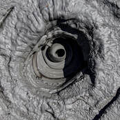
-- Mud Volcanoes --
|
- Tectonic Geomorphology:
quantitative geomorphic analysis of deformed Quaternary deposits to determine fault kinematics and constrain long-term
(1-100 ka) tectonic offsets,
- Paleo-seismology:
excavation of trenches across active faults to unravel the paleo-earthquakes history (1-10 ka),
- Geodesy:
monitoring of present-day crustal deformation (GPS) (1-10 years),
- Structural Geology:
determination of fault geometry and relationships between active deformation and geological structures, use of subsurface geometry of thrust faults and deformation models to convert surface uplift or folding into cumulative slip on the fault plane,
- Quaternary Geochronology:
dating of cumulative strain markers, typically Quaternary alluvial deposits (luminescence dating, cosmogenic exposure
dating, 14C).
We are also interested in what related archives from archaeology, paleo-climates, pedology, river processes... can bring to bear on the above questions.
